A white oak tree witnessed history in the making at Burlington Bay in the 17th century
Palaeobiology is all about putting the evidence of past life into the context of earth’s history. Sometimes this exercise does not produce the expected result.
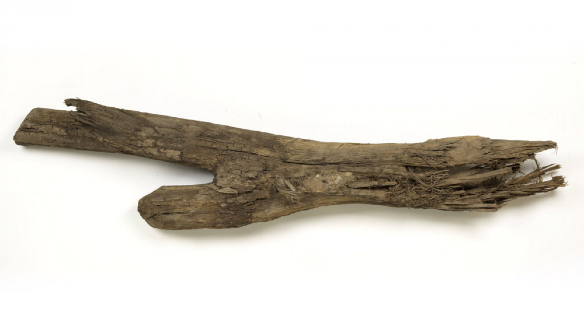
In November 2001, retired ROM Botany curator Jock McAndrews acquired a two-metre-long log that had been dug up during work on a loading-dock extension at Joseph Brant Hospital, not far from the shore of Lake Ontario near the mouth of Burlington Bay.
At the time, McAndrews was reviewing the ROM’s collection of postglacial wood. He identified the log as white oak. His analysis of pollen preserved in sandy clay scraped off the log’s surface indicated it had been buried in a marshy environment with mixed forest. This environment was consistent with our understanding of the shore of early Lake Ontario at Burlington Bay and could date back as far as 7,500 years. A large piece of postglacial oak was an exciting addition to the collection. We sent a sample of the wood to Brock University for radiocarbon dating, with every expectation that it would be confirmed as a window into a time when the land was recovering from millennia of being buried under ice.
Surprisingly, the radiocarbon date came back as much younger: our log was given a calibrated age of about 1650 CE, give or take a few decades. Rather than fitting our log into a geological context, we faced looking for an historic relevance.
There must have been plenty happening in the Burlington area in the mid-17th century, but a brief search for specific historic accounts was unsuccessful. Other priorities intervened, and with no apparent applicable context the log was relegated to a back corner of the invertebrate palaeontology collection room, where it sat for 17 years.
Then, in the Autumn 2018 issue of the journal Ontario History, there appeared Rick Laprairie’s account of a map of New France drawn in 1678 by French cartographer Jean-Baptiste-Louis Franquelin—a map which clearly portrays Burlington Bay. That article discusses other period maps of the Great Lakes and refers to the history of mid-seventeenth-century exploration and occupation in the area. Here was a pointer to the historic reference we needed.
The area of the lower Great Lakes has a deep history, but the earliest written accounts of European exploration in the Burlington area coincide roughly with the age of our oak tree. In 1669, René de Bréhant de Galinée, a French missionary and explorer, portaged overland with his Native guides from Burlington Bay to an Iroquois (Haudenosaunee) village known as Quinaouatoua, also called Tinawatawa, and from there to the Grand River to reach Lake Erie.
While at Quinaouatoua, de Galinée’s party met explorers Adrien Jolliet and Jean Peré, who were returning from investigating reports of copper deposits in the Lake Superior area, by way of Lake Huron, the Detroit River, and through Lake Erie, and are the first Europeans documented to have travelled that route in the other direction.
The decades before de Galinée’s account place our oak tree in the period of the so-called Beaver Wars, a time of fierce battle between Indigenous factions competing for control of the lucrative European fur trade throughout Ontario, New York, and into the Ohio Valley. There would have been considerable Indigenous traffic in both directions through the Burlington Bay–Grand River–Lake Erie portage route.
It turns out our log comes from an area that was well known in the 17th century as a transportation node, where cultural exchange transpired among Native peoples, traders, explorers, and missionaries.


